Different perspectives of development, intense transformation processes, and disputes for the access and use of natural resources in a territory result in emerging environmental conflicts.
With the project "Strengthening of social and ecological capacities of adaptation to climate change in the hydrographic basin of the Orotoy River" , the Humboldt Institute has proposed a managing model of processes of territorial management1.This initiative is based on the framework of integrated valuation of ecosystem services and the identification of common interests and socio-environmental conflicts of the local, sectorial, and institutional entities pertinent to each situation, which in this case is the Orotoy Basin.
The people in this area, whose economic and subsistence activities depend on the water resource, tend to blame the diminished water flow in the dry season as the cause of the reduced quantity and quality of the resource. Notwithstanding, they also relate this reduction to declines in most ecosystem services as the result of growing agro-industrial palm plantations.
This perception has been nourished by the abrupt changes in the natural and anthropic land covers experienced by the region. Between 1986 and 2000, 60% of dense forests were diminished and a fourth of the gallery forests were lost, whereas rice plantations reduced their extension by 75%. On the other hand, since 2000, oil palm plantations increased at a rate of 236 ha/year, standing out as a significant source of employment in the basin. In this area, there is evidence for two great drives of change: expanding palm plantations and the rapid establishment of extractive mining and energy systems. Although some of these factors have generated income, effects such as population growth and declining services supply to communities have arisen, and, in turn, created socio-environmental conflicts2.
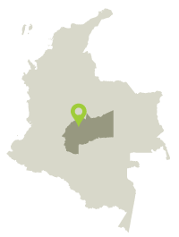
The project differentiates conflicts by the particularities of their location in the basin, location site, and the impacts generated by productive activities. For example, in the upper part of the basin, conflicts caused by water provision are dominant while in the middle basin mining, hydrocarbon exploitation, and palm plantations trigger conflicts. On the other hand, the lower part of the basin is the suitable setting for conflicts that are related to water quality because this area receives part of the polluting residues produced upstream. In addition to conflicts associated with water resources3, climate change is also identified as a future risk factor, for it will signify increasing temperatures and emerging novel agricultural plagues
There is scarce interest in the conjunct management of water resources between public and private entities, yet the solutions proposed by the project require the participation of the community. Sharing, diffusing, and discussing both scientific and local knowledge might encourage the active participation of all the persons involved. On the other hand, joining efforts and increasing social capital may create viable governance strategies for existing conflicts. In this sense, governance conditions should be established. These include: democratized information, community empowerment, guarantees for political volitions of government entities, and incentives for the participation of productive sectors.
 Village aqueducts
 Mining
 Hydrocarbon exploitation
 Palm plantations
 Water quality

 DOWNLOAD FILE IN JPG