The upper forest limit (UFL) is a global ecological condition determined by changes in environmental factors as altitude increases. Such changes limit the development of trees1 and enable the existence of other life forms with adaptations that are suited for survival in those areas. The tropical Andes are recognized as a transition zone between the high Andean forest and sub-paramo.
Although Colombia has a broad collection of information regarding paramo ecosystems, there is less knowledge about the UFL as a transition area, and data about species composition, changes in structure according to climatic and topographic conditions, ecological functioning, and related ecosystem services is scarce. These transition zones are acknowledged as systems with essential roles in the flux of organisms, materials, and energy between ecosystems2. In comparison to those adjacent ecosystems, the UFL differs in species composition, ecosystem functions, and temporal dynamics3.
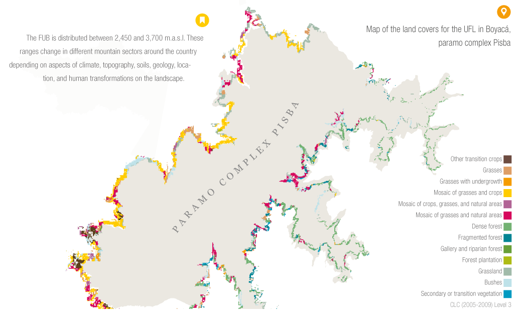
The altitudinal location of the UFL is dynamic in terms of space and time and is chiefly explained by variations in temperature4. Nevertheless, other factors and processes also determine the location of the limit at the regional and local levels: 1. Abiotic factors such as increasing radiation, low water availability, topography, and soil properties; 2. Human activities that cause changes in disturbance; 3. Biotic interactions such as competition or facilitation, limited dispersal3; and the presence of invasive species such as grass for cattle.
Spatial variations may include, for example, higher elevations of the UFL when mountain massifs are larger or higher. Similarly, in isolated areas or mountains of lower peaks, the limit may be located at lower altitudes (top, telescope of Massenerhebung effect) 5. Lower UFL are also found in drier slopes that present greater variations in water regimes, or in areas that are under anthropic pressures. (paramization).
In relation to temporal variations, pronounced rises and drops in the location of the UFL occurred during glacial and interglacial cycles of the Pleistocene, and more recently in the Holocene. During glacial maximums, the boundaries descended to between 800 and 1,000 m beneath current altitudes6.
Due to its close relation with temperature, the UFL is a potential indicator of the effects caused by global warming if ecosystemic distribution and structure is monitored. In conserved areas, global warming could result in an ascending limit whereas in transformed areas paramo pioneer species would descend, thus avoiding the regeneration of the forest.
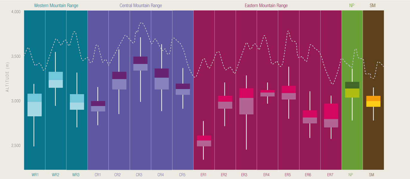
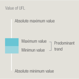
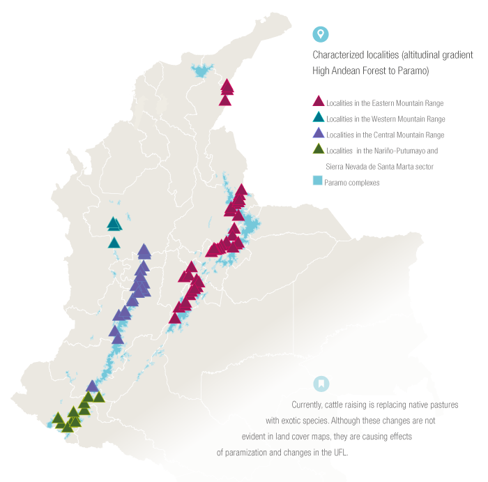
Thanks to the project Páramos y Humedales(Paramos and Wetlands), financed by Fondo Adaptación, it was confirmed that the UFL responds to topo-climatic and geological variables of the mountain ranges of the country; therefore, existing differences between regions and localities were evidenced. This finding allows for a differentiated management that considers specific characteristics of each region and locality.
Knowing the exact location and variations of the UFL is important in scenarios of climate change, decision making, and land use planning. It is necessary to develop more research to identify and quantify the anthropic pressures that mostly affect these areas since such pressures modify the location and cause the ascent of the UFL.
 PDF version
 Methods (in Spanish)
 References
 Share
Share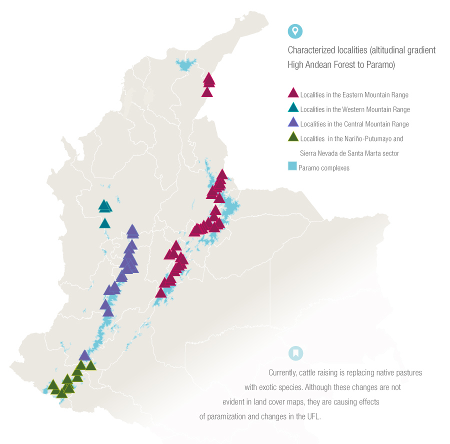