As part of conserving paramos and their associated
ecosystem services, these ecosystems have been
delimited in detail. Yet these endeavors are insufficient
for the protection of the ecosystems, for processes of
integrated biodiversity management in broader contexts
that include ecosystem gradients such as the high
mountain are yet to be created.
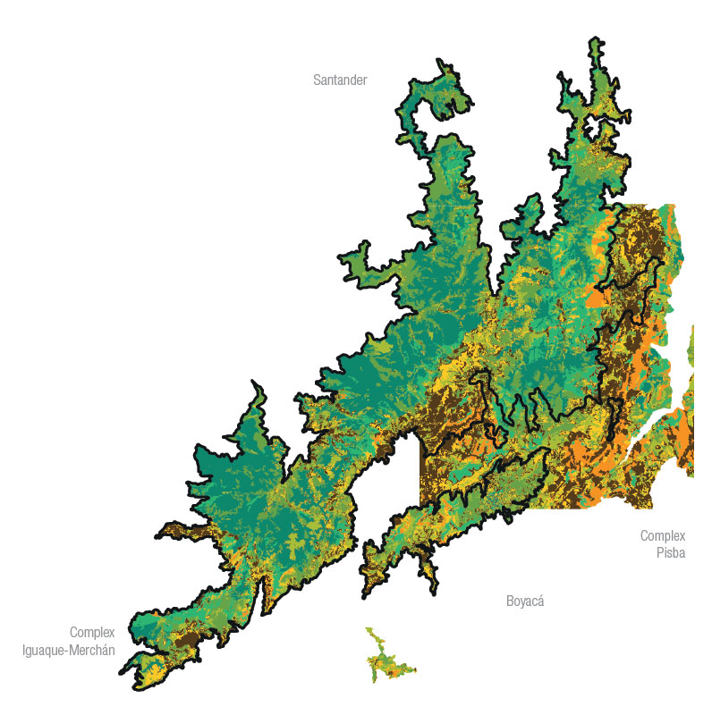
With this purpose, the Humboldt Institute and the
Ministry of Environment present a methodological
proposal that uses as a case study the paramo complex
Guantiva-La Rusia and includes variables of “status”
and “pressure” that represent the conservation status
and anthropic threats of the ecosystems. Based on
this, guidelines for management, such as social and
institutional responses, are formulated for evaluation,
feedback, and monitoring to determine their effectiveness.
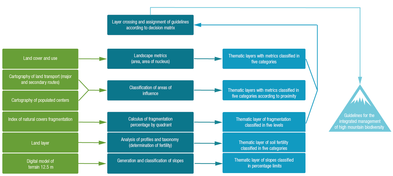
The hypothesis for high mountain integrity at a
semi-detailed scale (1:100,000) is generated based on
landscape metrics and ecological connectivity. This is how
paramos are integrated with surrounding ecosystems
and an ecological structure is ensured to guarantee
ecosystem functionality and the offer of ecosystem
services. At this point more detailed information may be
generated based on developed hypotheses.
Posteriorly, using a land covers analysis, the
conservation status of involved ecosystems is estimated
at a 1:25,000 scale. Therefore the status of the paramo
complex is determined by indicators of composition (total
area of the fragment, area and shape of the nucleus) and configuration (distance between fragments) according to
the landscape matrix.
The biophysical conditions of surrounding areas
and the access that human populations have to natural
remnants represent an opportunity for extracting natural
resources and thus altering the natural system. In
this sense, variables that allow for the identification of
pressures in those areas where threats to ecological
processes exist must be incorporated. Consequently,
indicators of intensity of use (distance to roads and
settlements, land use types, and fragmentation) and
biophysical vulnerability (fertility and slope) are included in
order to evaluate pressures on the ecosystem.
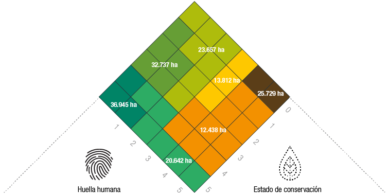
Finally, ecological integrity is estimated based on
the status of the fragment and anthropic pressures or
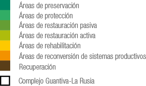
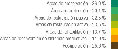
human impact. This result leads to the formulation of
management guidelines for the areas assessed, using
as a framework the established conservation dimensions
proposed by the Convention on Biological Diversity
(preservation, restoration, and sustainable use) and the
particular governance norms of Colombia.
 PDF version
 Methods (in Spanish)
 Share
Share 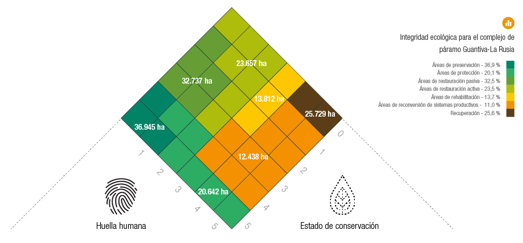