The folded topography of the Andes makes of Colombia a geographically heterogeneous country and creates a hydrographic network that combines basins of different dimensions, physiography, and types of water. It may divided into four water catchments: Caribbean, Pacific, Orinoquia, and Amazon. As the institution in charge of zoning the country’s hydrography, the Instituto de Hidrología, Meteorología y Estudios Ambientales (Institute of Hydrology, Meteorology, and Environmental Studies-Ideam) classifies and prioritizes units of analysis for the planning and management of water resources based on regional basin borders and only in terms of political divisions to manage basins by sections1.
A regional classification of freshwater ecosystems that combines both geographic and biological criteria does not exist for Colombia despite its utility in understanding the territory and defining conservation and management strategies. Within an ecoregion, species, ecological dynamics, and environmental conditions are more similar than surrounding ecological regions; therefore an ecoregion itself is a unit of conservation.
At a global scale, there is a proposal of defining ecoregions in freshwater ecosystems2. This proposal makes evident that regionalization exercises are important for establishing freshwater protected zones and highlights the inexistence and precariousness of appropriate models for protection measures. While managing these models globally, practically all biogeographical particularities of Northern South America are excluded.
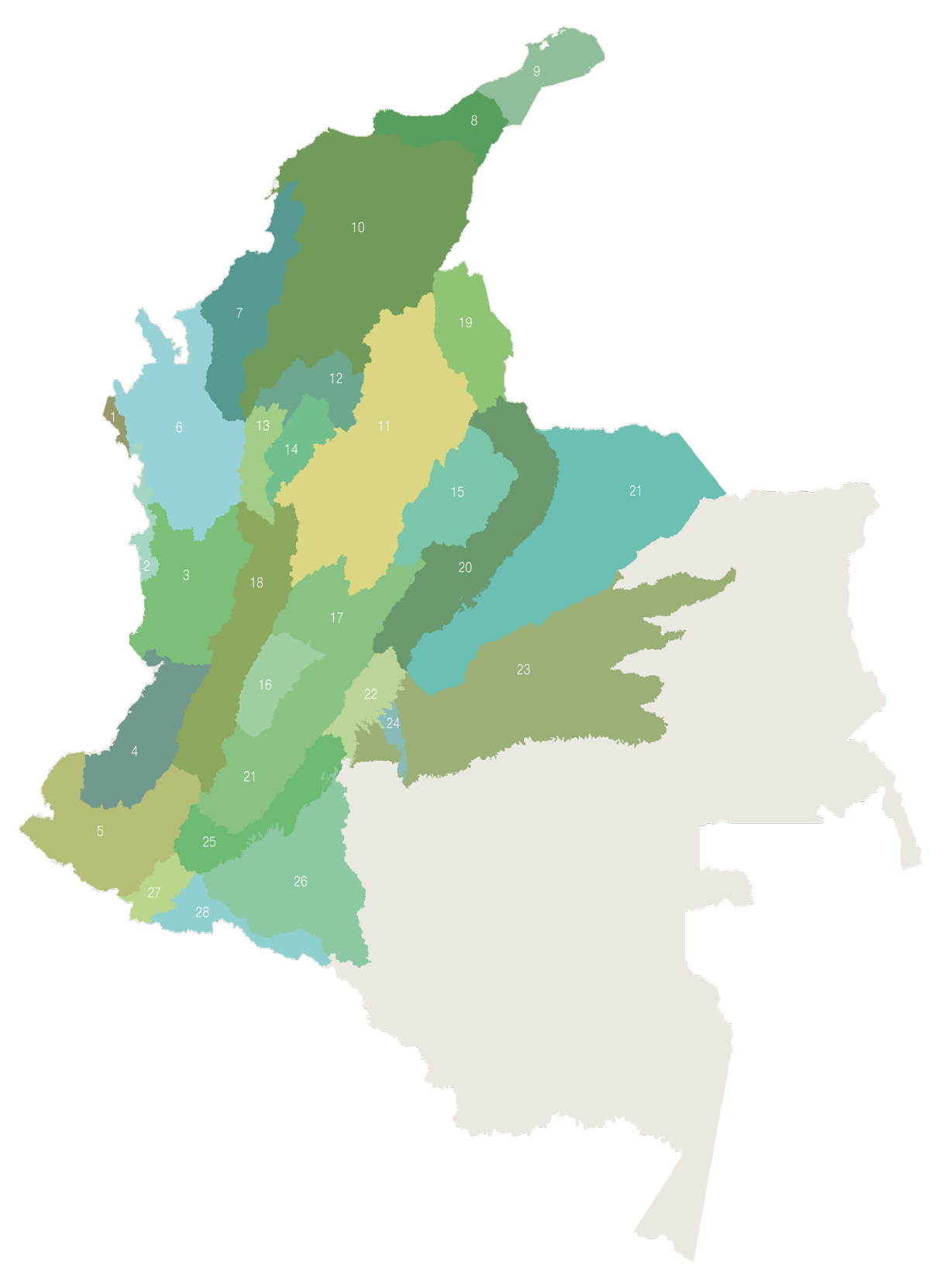
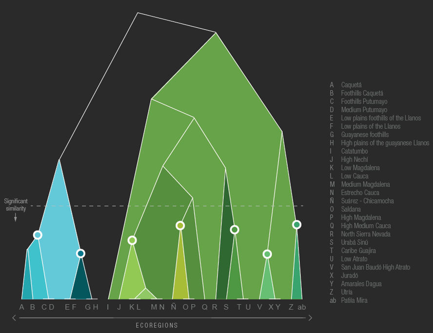
In this proposal, the established hydrographic zones3 were regrouped according to the composition of fish species, interpreted drainage network and geomorphological characteristics of the basins. In addition, the fish composition and associated geographical attributes were considered as an identity indicator for each ecoregion. 28 freshwater regions are proposed4, all of which are grouped into two big regions (Trans-Andean and Cis-Andean) and four water catchments. These identified regions may be used in territorial planning, and, according to the proposed conservation goals, may be subdivided altitudinally where there is a differential fish species composition or particular jurisdictions. This tool may be especially useful when defining protected areas or in response to the four levels of territorial planning that link hydrographic basins (large basins and national order plans, hydrographic zones and basins where land use planning and environmental management of hydrographic basins) are developed, small basins, and aquifers1.
The greatest differences related to recognized hydrographic zones in Colombia are in species composition and the geomorphology that limits distribution. It is important to recognize the existence of geomorphology, how it shapes the territory, and that it is posterior to the establishment of geoforms in order to understand that fish distribution depends of the relief of the surface and limits of rivers. However, shared distributions and species characteristics are illustrative of historic processes. In conclusion, to create a robust territorial management proposal, geology and hydrology must be integrated in initial phases and biogeography must be verified, complemented, and discussed using as a base the distribution of fish species.
The proposal of ecoregions gives a more complete vision about the territory since it includes an ecological study and the natural histories of some organisms. Approaches such as this one would be greatly useful for territorial planning exercises, conservation plans of aquatic resources, and plans for environmental compensations in freshwater ecosystems.
 PDF version
 Methods (in Spanish)
 References
 Share
Share