Wetlands are ecosystems that are formed where water
is temporally or permanently accumulated in response
to geomorphological and hydrological conditions, which
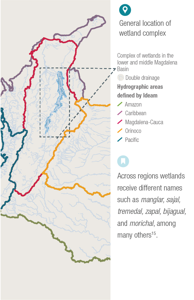
imply particular characteristics of the soil, fauna, and flora1. In Colombia, there are wetlands in all the regions of
the country2, and they may be found from sea level all the
way to the high mountains. The area of wetland does not
only include the body of water but also those parts that
periodically dessicate, even those that are never flooded
but have characteristics of high humidity and soil processes.
In 2010-2011 the phenomenon of La Niña brought
floods that resulted in the death of 1,100 people and
economic costs of 11.2 billion pesos3. Such catastrophe
initiated unprecedented research at a national level that
allowed for a greater understanding of the wetlands of
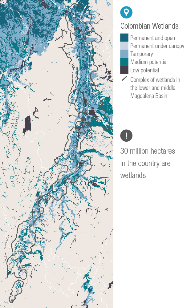
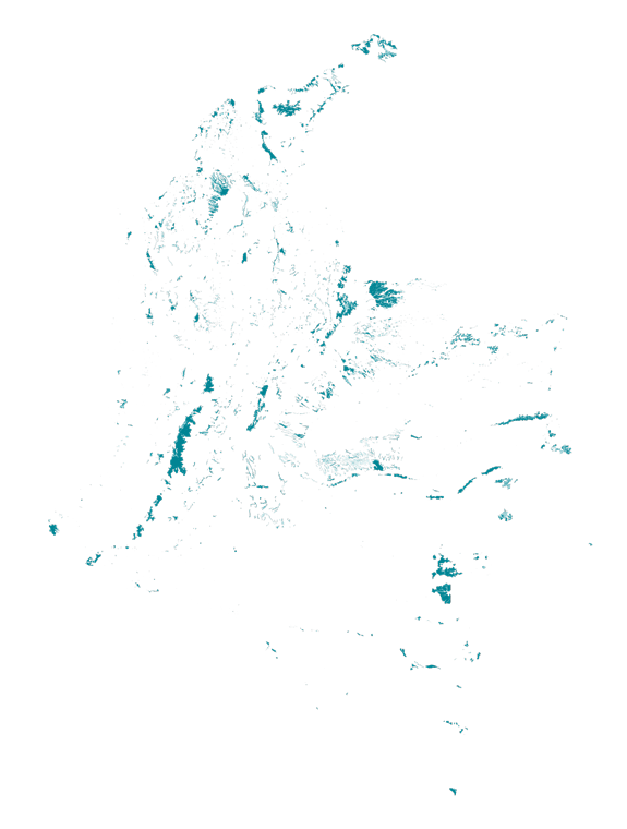
Colombia. As part of the obtained results, the cartography
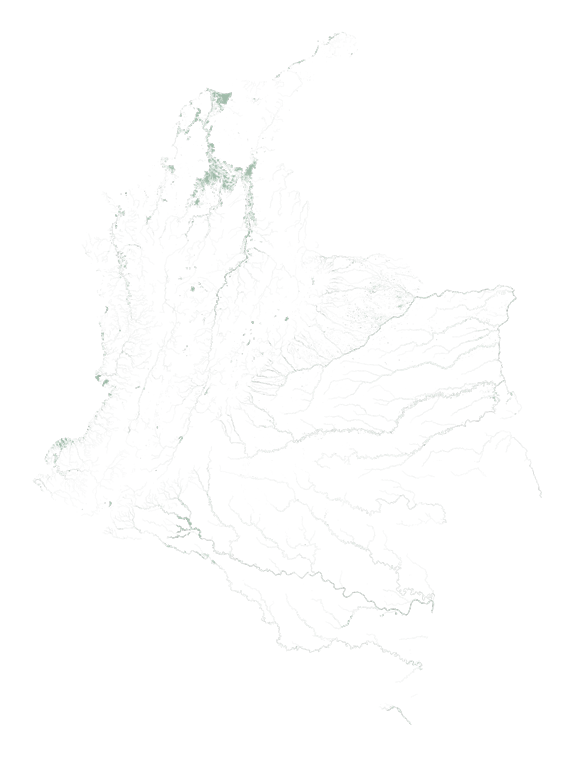
of wetlands shows that more than 26 % of the national
territory is composed of wetlands. The map identifies
the fluctuating nature of wetlands in three categories:
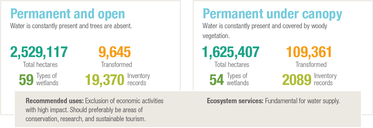
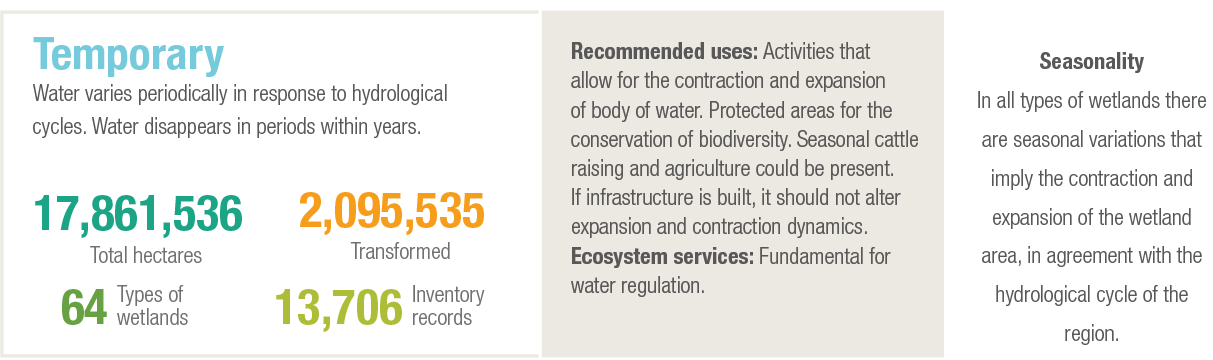
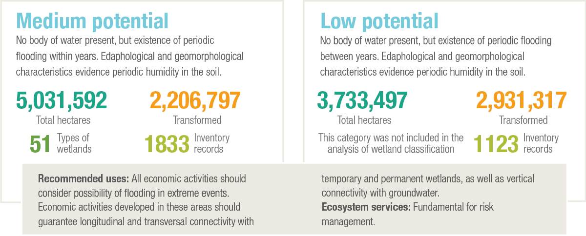
permanent, temporal, and potential4,5. Each type must be
understood and used in a differentiated manner. In permanent
wetlands, it is necessary to guarantee that no
reduction in the flow of water occurs through deviations
or actions that result in desiccation. The fluctuation of
flooding in temporal wetlands generally has an interannual
cycle that corresponds to the expansion of rivers and
other bodies of water in periods of heavy rain. Areas of
potential wetlands are also susceptible to flooding but in a
lower interannual frequency.
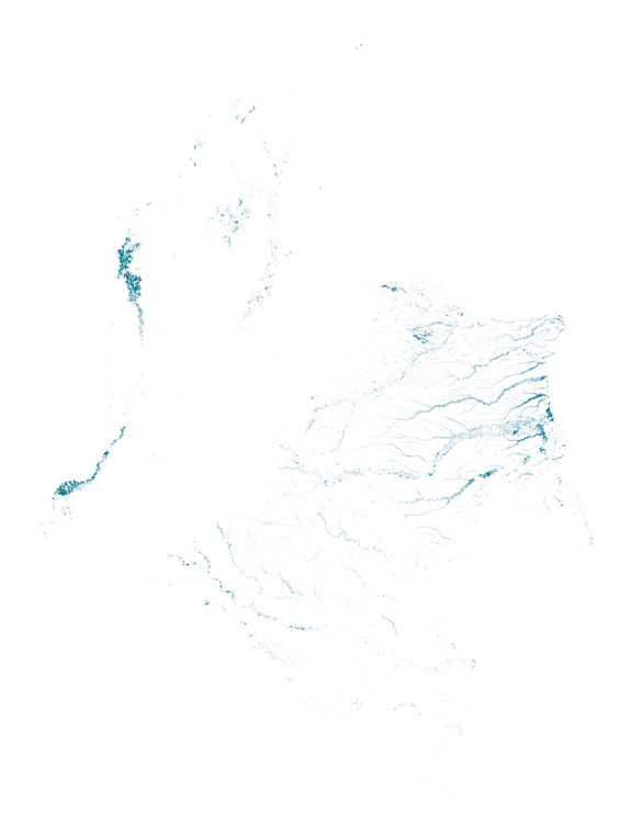
Based on the previous information, an analysis about
the transformation of wetlands evidenced that 24 % of
wetlands have suffered some change in land covers, between
2007 and 2012, due to anthropogenic activities.
The regions of the Urabá, Orinoquía foothills, and the Sinú
and Mojana basins9 are the most affected by such transformations.
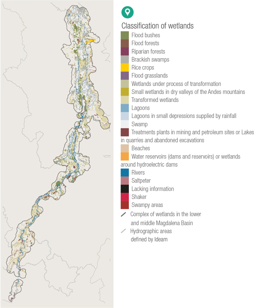
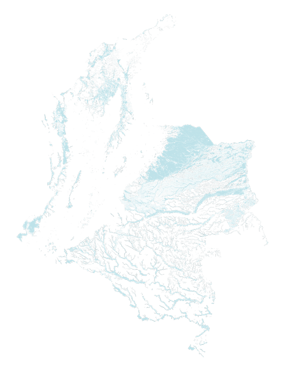
Additionally, a classification system categorized the 30
million hectares that have been identified according to the
type of wetland, reaching more than 88 categories for all
of the country2,10. Based on the updated information found
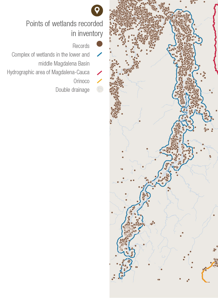
by participating institutions, the records were organized
and collected to form a national inventory with more than
48,000 records11 grouped into 134 complexes.
Colombia is clearly a territory dominated by water, so
it is necessary to highlight the opportunities and benefits
this condition brings. A total of 1,100 municipalities have wetlands, of which 284 are covered with more than 30%
by water. Some of these, like Mompox (99.98 %), Cravo
Norte (99.91 %), Sitio Nuevo (99.76 %), Pinillos (99.41
%), and Orocué (99.21 %)12,13 are almost totally covered
by water. Ignoring such reality in territory planning and the
adaptive development of populations has caused consequences
such as the increase of catastrophes related to
drought and flooding.
The only way of implementing an effective risk management
is by acknowledging the territorial as amphibian (periodic flooding and drought) and encouraging the recovery
of ways of life adapted to these conditions in the
populations that inhabit the territory. A first step to accomplish
such goal is to incorporate generated information
to tools of territorial management such as the Planes de ordenación y manejo ambiental de cuenca hidrográfica
(Land Use Planning and Environmental Management
Plans of Hydrographic Basins) and Planes de Ordenamiento
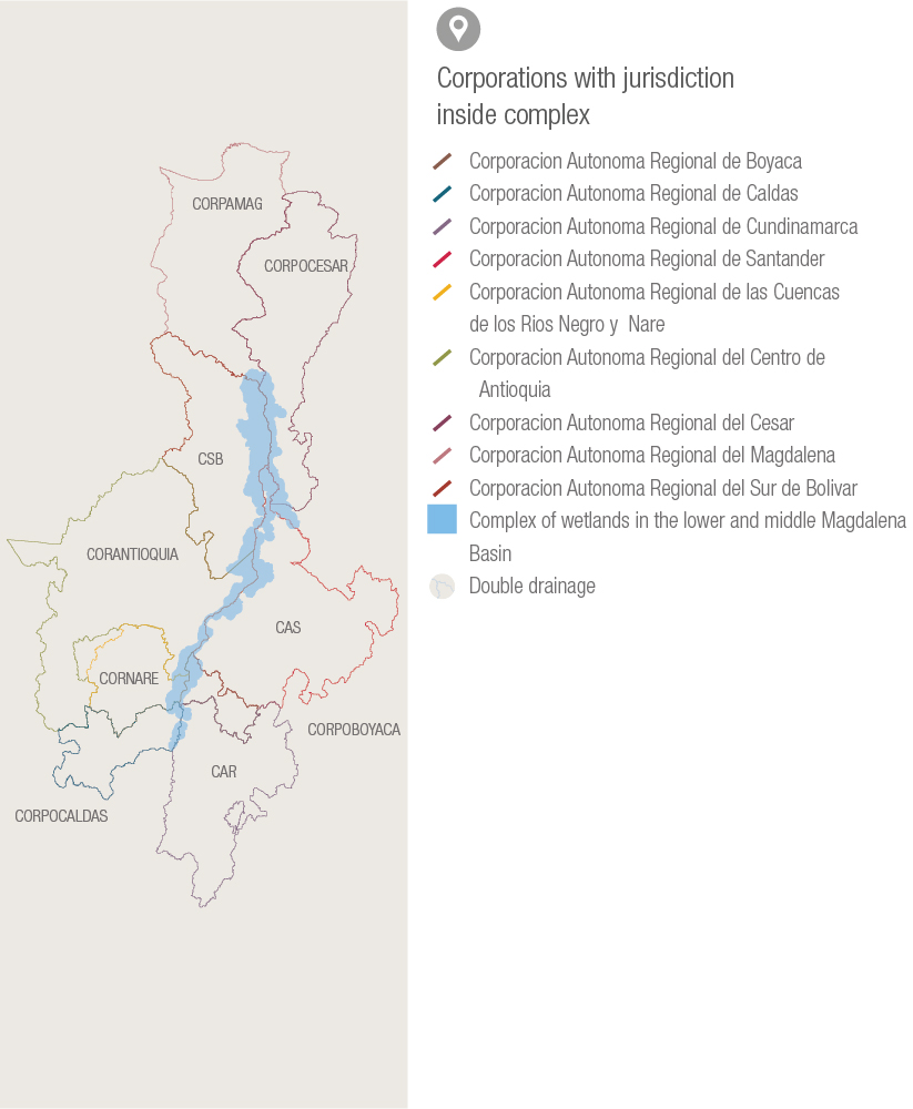
Territorial (Land Use Planning) to reach a differentiated and integrated management by environmental authorities.

 PDF version
 Methods (in Spanish)
 References
 Share
Share